
The Layout of Netzarim Junction
Without an understanding of the layout of Netzarim Junction, one cannot understand the evidence.
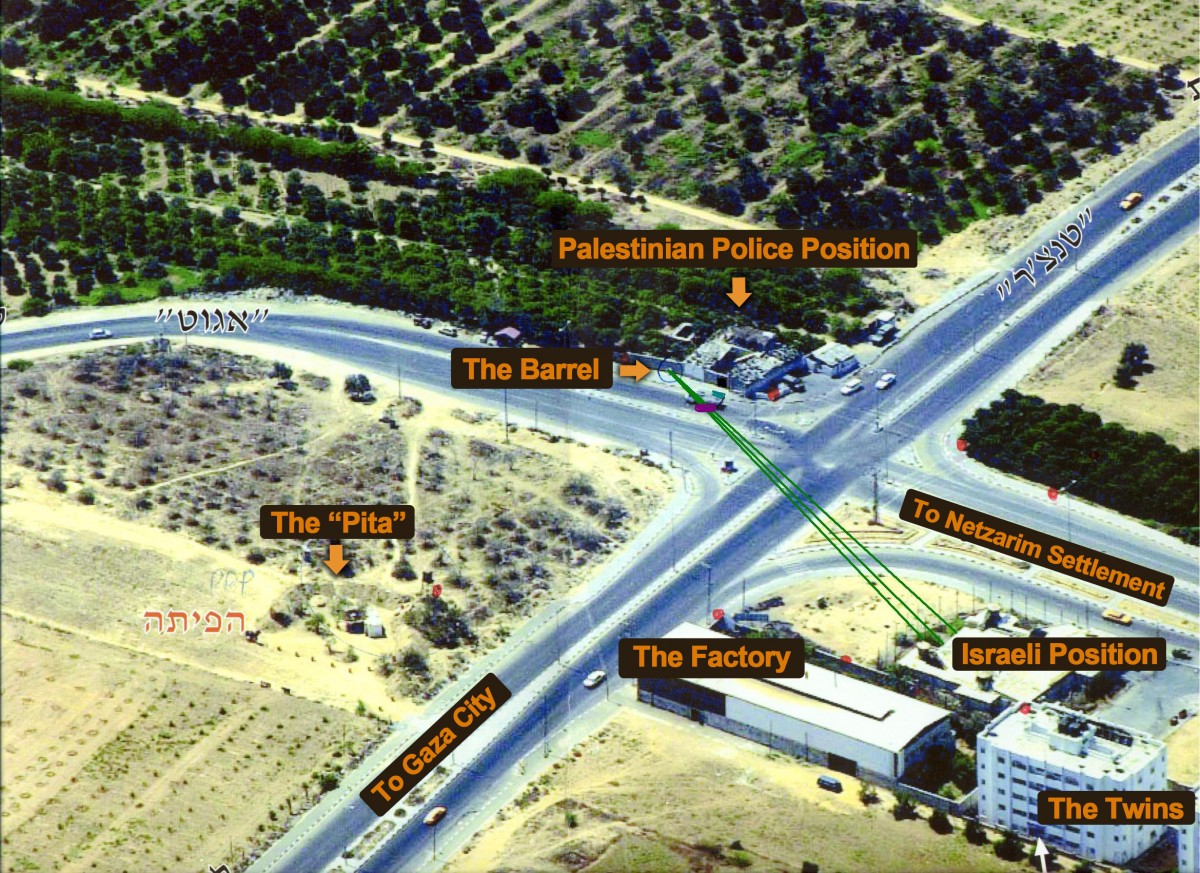
The barrel behind which the Al Durah’s took refuge is at the top center of the picture. To the right at the intersection lies the Palestinian police station from which we have footage of extensive gunfire at the Israeli position. The jeep scene took place just in front of the barrel. At the end of the wall, to the left is an area from which we have footage of Palestinians firing at the Israelis (from behind the Al Durahs) as well.
The Israeli position is diagonally across the street from the barrel where the father and son hid. The most direct angle from which the Israelis could shoot at the barrel was 30 degrees. It is important to understand that the Israelis never left their position that day (or for the succeeding week), and that any fire outside of the range of their guns must, of necessity come from Palestinian gunmen.
Across the road, more or less directly opposite the wall was a mound of dirt call the “Pita” behind which we have video of armed Palestinian gunmen. They are largely out of range of the Israeli position. On the other hand, were someone to fire from this location at the barrel, the bullets would hit the wall more or less directly at a 90 degree angle (i.e., head on).
Next to the Israeli position are two buildings, an (inoperative) factory, and the “twins,” towers built to house the families of Palestinian policeman charged with coordinating the implementation of the Oslo Accords with the IDF. Behind the factory and along the road in the lower right-hand side of the picture is an area that was entirely out of Israeli firing range for that day, and yet several scenes of gun battles were filmed there (see Pallywood).